Judith Buckrich
Judith Buckrich has had a long involvement with the arts and literature and has written many books. Her presentation focused on the Yarra River which runs for 240 kms from its source near Mt Baw Baw in the Yarra ranges, to its mouth at Port Phillip Bay.
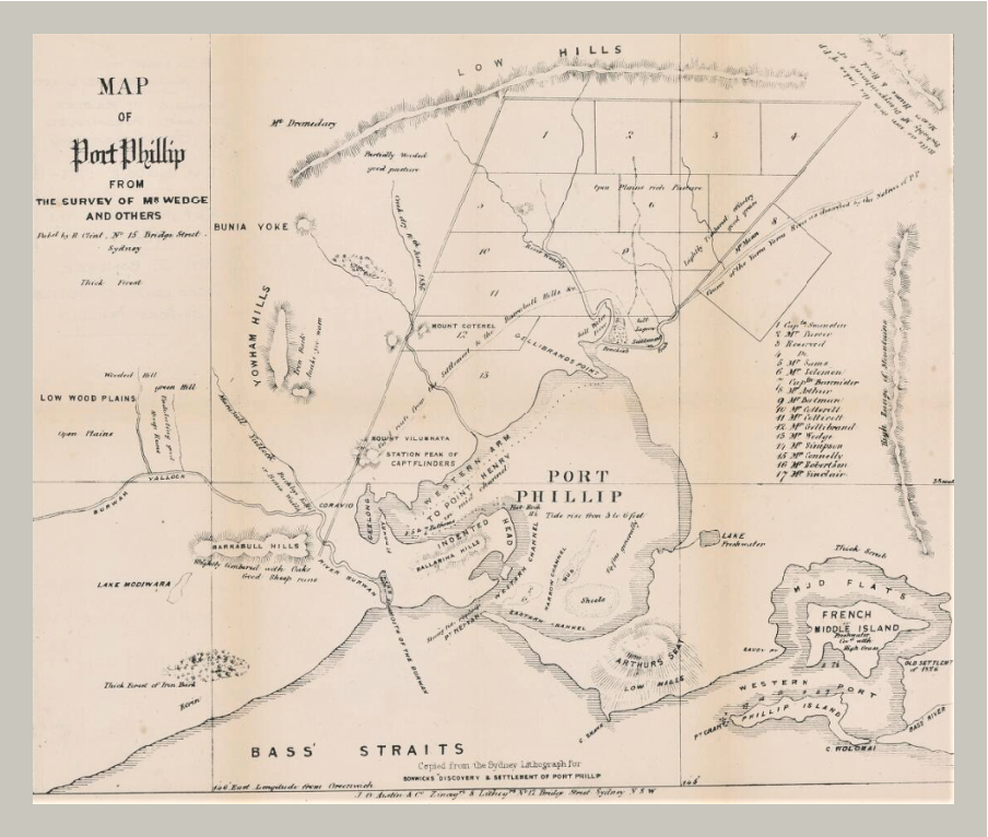
Map of Port Phillip from the survey of Mr. Wedge and others, 1836. Source: nla.gov.au
As photography was non-existent at the time of the Port Phillip settlement, early depictions of Melbourne are to be found in illustrations and paintings, the first being the 1835 map of the Port Phillip District, made by surveyor, John Helder Wedge. (above)
The mouth of the Yarra River finished as a delta and extended around the northern end of Port Phillip Bay. It often flooded, affecting the areas, which became Prahran, Collingwood, Richmond, South Yarra, St Kilda, Elwood and South Melbourne. On the west side of the river there was the Blue Lake/West Melbourne Swamp.
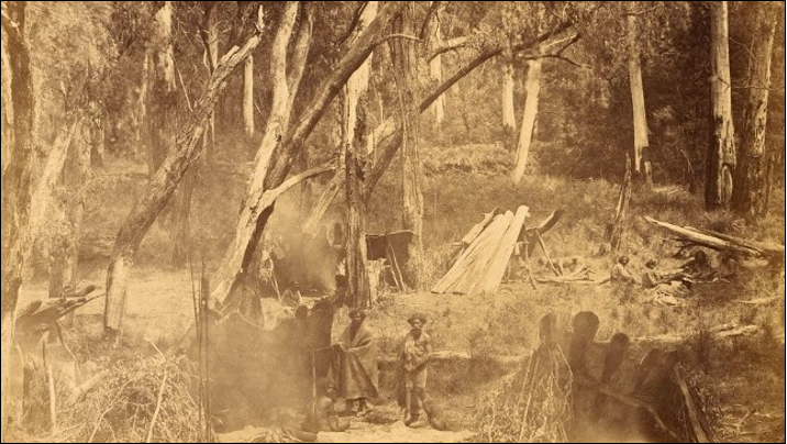
Aboriginal camp 1858 Richard Daintree & Antoine Fauchery (SLV)
Before European settlement it had been a beautiful, unpolluted salt water lake with prolific wild life and plants providing food for the local Wurundjeri people. After white settlement it became a garbage dump.
Level with Queen Street in Melbourne, rocks which spread across the river created a small waterfall and separated fresh water coming downstream, from salt water coming up from the Bay. The rocks were also a means of crossing the river on foot. Later a ferry traversed the river above the falls, and below the falls there was a turning basin for small craft.
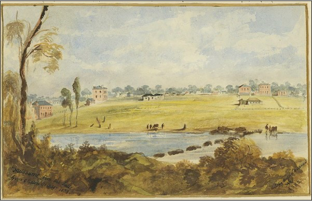
Robert Russell Melbourne from the Falls 1938
Surveyor, Robert Russell, lived on the south side of the Yarra River for many years, and he painted the scene from his front door. The falls are clearly visible in his pictures and over time his paintings show the progression of the town of Melbourne on the north side of the river.
Wilbrahim Liardet “Landing at Melbourne’ source Wikimedia
Wilbraham Liardet painted a picture in 1838 of the first punt crossing the river, but by 1840 there was a rough wooden trestle bridge. A hotelier, Liardet wrote a history of Melbourne which included his own illustrations. His distinctive water colours of places and people are a wonderful record of the times.
Henry Eason Davies’ beautiful paintings of the Yarra River in South Yarra and Richmond indicate that outside of the town centre, the area remained rural for a long time.
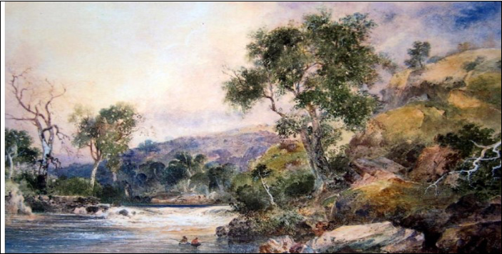
Henry Eason Davies – Dight’s Falls Yarra River
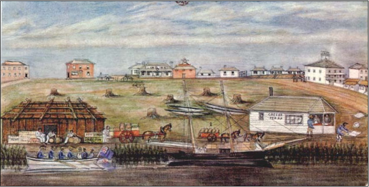
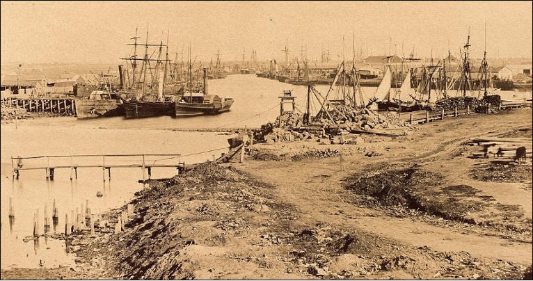
The goldrush in Victoria brought an influx of immigrants, and early photos show the jostle of sailing ships tied up at Queen’s Wharf in Melbourne. Until the creation of the Coode Canal in 1886 and the bypassing of a narrow bend in the River only small craft could reach Melbourne. Bigger ships docked at Hobson’s Bay where goods were transferred onto lighters and then conveyed up stream. Passengers could travel the same way, for a fee, or they could walk to Melbourne.
Photograph by Antoin Fauchery & Richard Daintree c1858 (SLV)
Ships were often abandoned as crews rushed to the gold fields and a ‘canvas town’ of tents sprang up on the southern bank of the Yarra. There were many homeless people, some living along the river, and some on the beach.
At Warrandyte where the goldrush began, the Yarra underwent changes. At Pound Bend, the River makes a big turn and loops back on itself. In the 1870s a tunnel was drilled through a rock wall at the narrow end of this loop, allowing a diversion of the river through the tunnel. This enabled gold panning in the loop itself.
The trestle bridge in Melbourne was replaced in 1850 by a single arched stone bridge. It is seen in many early photos and paintings. The present bridge was built in the 1880s. The Cremorne railway bridge crossed the Yarra River at Cremorne, a small suburb in the vicinity of Richmond, having the Yarra River as its southern boundary. In the 1870s there was a Fun Park at the Cremorne Gardens and people were conveyed up the river by paddle steamer to enjoy it. Rowing became a popular sport once all the logs and branches had been removed from the river.
Polluting industries requiring water such as tanning, wool washing, and abattoirs proliferated along the Yarra from Footscray up to the falls in Melbourne and beyond. These industries gave Melbourne a putrid smell giving the city the nickname ‘Smellbourne’.
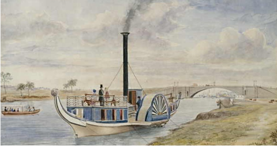
Paddle Steamer Gondola steaming to Cremorne Gardens 1855
Many artists and photographers came to Melbourne, some being revolutionaries like artist, Nicholas Chevalier. He did wonderful water colour paintings in Australia and New Zealand. Louis Buvelot was also an admirable artist and photographer. Their paintings like those of Eugene Von Guerard initially looked ‘European’ but gradually they adopted the colours and atmosphere of the Australian landscape. They had significant influence on the Heidelberg School of painters.
The Yarra Bend Lunatic Asylum, built in the late 1840s upstream from Dights Falls, was a grim place for the inmates, albeit in a beautiful location. Early drawings and paintings show the buildings and its surrounds.
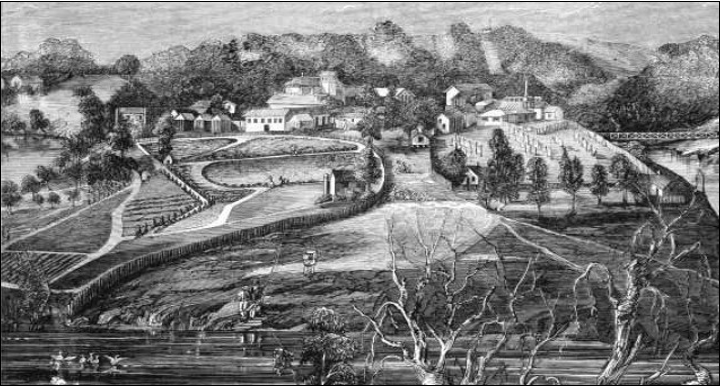
1863 Wood Engraving of Y”area Bend Asylum for the insane
Even as Melbourne changed around them, many Wurundjeri people remained in the area. Antoine Fauchery took outstanding photographs c1858 of aborigines wearing possum skin cloaks.
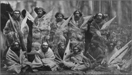
Aboriginal Tribesmen 1858 Antoine Fauchery (SLV)
John Cotton was one of the few artists to paint the indigenous people in their surroundings.
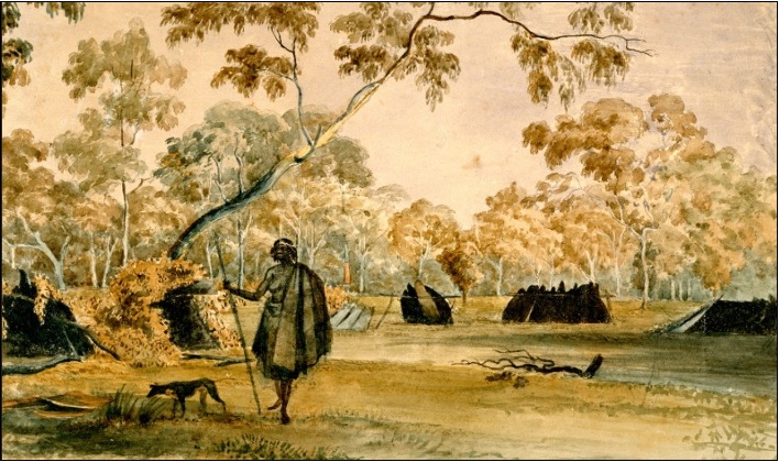
John Cotton c1845 Natives Bathing on the Yarra (SLV)
In 1863 The Coranderrk Aboriginal Station was established at the confluence of the Yarra River with Coranderrk/Badger Creek. The station was closed in 1924.
It is possible to go and see where the Yarra River enters Port Phillip Bay, but the source of the River amongst the magnificent Eucalyptus Regnans forest is closed off to visitors. We must instead be content to look at the early paintings and photographs.
Summary contributed by Jan Hanslow PPPG member No 1057